Журнал изменений
Описание версий программного комплекса IMC
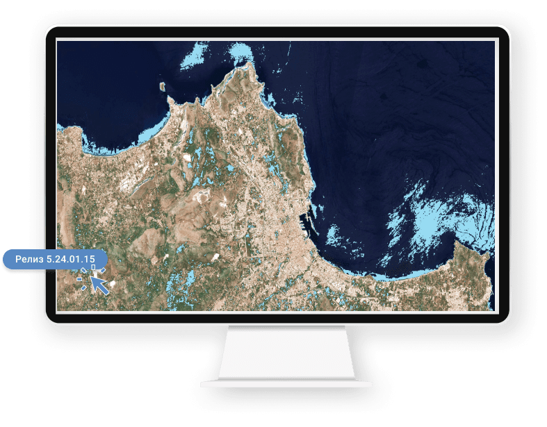
Релизы IMC
Добавлено:
- Добавлена поддержка открытия паспорта аппарата Ресурс-П №4.
- Добавлена поддержка изображений в проекции план-схема для расчета линейного разрешения на местности .
- Добавлен функционал работы с каналами КА MERSI-2.
- Расширен функционал работы с переменными программы.
- Добавлена возможность трансформирования изображения по внутренним точкам геопривязки.
Обновлено:
- Обновлен инструмент и интерфейс проверки топологии.
- Улучшен функционал расчета шумовых характеристик.
- Доработан функционал элемента Таблица при формировании отчета.
- Доработан интерфейс модуля оценки качества изображений.
- Улучшен алгоритм формирования канала прозрачности при копировании области изображения.
- Обновлен функционал расчета моделирования распространения пожаров.
- Доработан модуль чтения слоев КА Modis.
- Усовершенствован модуль чтения файлов формата TIFF.
- Усовершенствован модуль выполнения макросов.
- Улучшен алгоритм классификации изображений методом нечеткой классификации.
Исправлено:
- Исправлена ошибка в алгоритме расчета размера документа.
- Исправлена ошибка в модуле первичной обработки материалов КА Канопус-В.
- Исправлено мерцание изображения при работе с материалами КА MERSI-2.
- Исправлена ошибка проверки действующих указателей в модуле расчета буферных зон.
- Исправлена ошибка в модуле чтения файлов XML.
- Исправлена ошибка в алгоритме разбивки векторных объектов.
- Исправлена ошибка индикатора выполнения процесса.
- Исправлена ошибка определения минимального и максимального значения пикселей в области при расчете гистограммы.
- Исправлена ошибка в формировании слоя отчета.
- Исправлена ошибка при выводе на экран слоя точек привязки.
- Исправлены критические ошибки, которые могли вести к падению программы.
Добавлено:
- Добавлена колонка "тип пикселя" в инструменте мозаика.
- Добавлены параметры командной строки для модуля оценки качества изображений.
- Добавлен функционал трансформирования изображений по имеющимся в файле RPC-коэффициентам или точкам привязки для режима макроса.
- Добавлены новые функции в панель переменных.
- Добавлен функционал расчета линейного разрешения на местности для изображений, не имеющих географической привязки.
- Добавлены параметры в функцию изменения размера изображения.
- Добавлены новые сообщения в файл журнала работы программы.
- Добавлена возможность сшивки мозаики в случае, если у изображения имеются отрицательные значения пикселей.
Обновлено:
- Доработан инструмент копирования изображений.
- Расширен функционал чтения паспортов КА: Ресурс-П уровня 1А, Канопус-В.
- Обновлен алгоритм геокодирования.
- Доработан модуль чтения паспорта КА Кондор-ФКА.
- Доработана форма выходного отчета в модуле оценки качества.
Улучшено:
- Улучшен интерфейс визуализации точек привязки.
- Усовершенствован функционал чтения файлов HDF.
- Усовершенствован алгоритм расчета линейного разрешения на местности для изображений.
Исправлено:
- Исправлена ошибка в алгоритме выделения диапазона.
- Исправлена ошибка выделения контура изображения.
- Исправлена ошибка выполнения в макросе функции изменения свойств изображений.
- Исправлена ошибка в чтении параметров Датума.
- Исправлена ошибка проверки пустот в полигонах в модуле проверки топологии.
- Исправлена ошибка сдвига векторного слоя.
- Исправлена ошибка при перемещении элементов дерева макроса в панели операций, приводящая к падению программы.
- Исправлена ошибка некорректного идентификатора в панели операций.
- Исправлена ошибка в векторном калькуляторе.
- Исправлены критические ошибки, которые могли вести к падению программы.
Добавлено:
- Добавлена поддержка чтения паспортов и загрузки данных с КА: Gaofen-1, Jilin-1, SBERS-4, ResourseSat-2A, ZY3, FY-3D, MERSI-2.
- Добавлен инструмент разделения векторных объектов типа: комплексная точка в простые точки.
- Добавлен новый тип переменных в работе макросов.
- Добавлена возможность работы программного комплекса на двух мониторах.
- В модуле оценки качества добавлена возможность записи в макрос действия: "Сохранение данных в файл точек".
- Добавлено в запись макроса действие включения/выключения видимости слоев.
- Добавлен алгоритм поиска термоточек по данным с КА: MERSI-2, FY-3D.
- Добавлены автоматическое определение и поддержка кодировки 1251 строк таблицы векторных объектов.
- Добавлена поддержка полярной стереографической проекции.
- Добавлена поддержка пикселя размера 64 бит в формате TIFF.
Обновлено:
- Обновлен алгоритм копирования области изображения по отметке со сглаживанием краев.
- Доработан алгоритм геотрансформации слоев отметок.
- Оптимизирован алгоритм чтения и сохранения файлов формата PNG.
- Доработан алгоритм расчета разрешающей способности снимка.
- Доработан алгоритм геометрической точности снимка.
- Доработан модуль чтения метеоданных онлайн с веб-служб.
Улучшено:
- Усовершенствован алгоритм построения мозаики в плане повышения быстродействия.
- Улучшен алгоритм построения отметки по цветовому диапазону.
- Усовершенствован алгоритм восстановления пропущенных строк на изображении.
- Усовершенствован алгоритм поиска резких краев на снимке.
- Повышена точность геотрансформации изображений по RPC-коэффициентам с использованием файла рельефа.
- Улучшен алгоритм расчета шумовых характеристик изображения.
Исправлено:
- Исправлена ошибка перекодирования строк в таблице атрибутов векторных объектов.
- Исправлена ошибка конвертации UTF-8 векторных файлов формата SHP.
- Исправлена ошибка в диалоге информации о каналах.
- Устранена ошибка закрытия документа в работе макроса.
- Исправлена ошибка в модуле построения композитного изображения, если имена каналов превышают 128 символов.
- Исправлена ошибка переименования действия сохранения отчета во время выполнения макроса.
- Исправлена ошибка при создании директории в модуле коррекции радиометрии радиолокационных материалов.
- Исправлена ошибка в поведении инструмента выбора цвета.
- Исправлена ошибка в модуле построения среза спектрограммы при работе с мультиспектральными и гиперспектральными данными.
- Исправлены критические ошибки, которые могли вести к падению программы.
Добавлено:
- Добавлена функция автоматической расстановки точек на заданных участках изображения в модуле геопривязки по точкам.
- Добавлен алгоритм проверки проекции и пересчета размера пикселя на сфере.
- Добавлен алгоритм построения внутренних линий сшивки при формировании мозаики.
Обновлено:
- Обновлены алгоритмы обработки данных для КА Канопус-В.
- Обновлен модуль чтения паспорта данных с КА "Кондор-ФКА".
- Обновлен алгоритм проверки корректности географической системы координат в данных с КА Канопус-В.
- Обновлен модуль пересчета значений яркости пикселей изображений в физические величины.
- Доработан модуль автоматического выполнения макросов.
Улучшено:
- Усовершенствован модуль открытия данных по паспорту КА Кондор-ФКА.
- Усовершенствованы алгоритм и интерфейс добавления опорных точек в модуле геопривязки.
- Улучшена цветовая визуализация точек привязки.
- Усовершенствован механизм распределения памяти для высоконагруженных и ресурсоемких операций.
- Усовершенствован модуль формирования отчетов.
Исправлено:
- Исправлена ошибка блокировки данных при параллельных вычислениях.
- Исправлена ошибка функции инвертирования отметки.
- Устранена ошибка в модуле поиска резких краев на изображении.
- Исправлены критические ошибки, которые могли приводить к падению программы.
Добавлено:
- Добавлен модуль работы с сервисом meteoeye получения оперативных данных по термоточкам.
- Добавлена возможность вносить в отчеты информацию о географической системе координат.
- Добавлены новые поля и источники на скачивание метеоданных в формате Grib.
- Добавлены новые функции создания папок при работе в режиме макроса.
- Добавлена поддержка режима макроса в функции ортотрансформации изображений.
- Добавлены алгоритмы обработки данных для КА LandSat-9.
Обновлено:
- Обновлен модуль чтения данных с КА «Кондор-ФКА».
- Обновлен модуль перерасчёта данных, получаемых с КА Канопус-В, в физические величины.
Улучшено:
- Усовершенствован модуль открытия данных по паспорту КА LandSat-8.
- Усовершенствован модуль сохранения растровых данных в формат TIFF со сжатием JPG.
- Усовершенствован функционал формирования и сохранения отчетов.
- Доработан алгоритм работы с относительными путями в макросе.
- Доработаны модули загрузки паспортов данных ДЗЗ видимого и радиолокационного диапазонов.
- Усовершенствована функция взаимной привязки изображений.
Исправлено:
- Исправлена ошибка в модуле оценки качества, векторных объектов.
- Исправлена ошибка функции сохранения отчета.
- Исправлена ошибка в функции добавления растров.
- Исправлена ошибка выбора растров при уточнении взаимного положения маршрутов.
- Исправлена ошибка вырезания растра по границе.
- Исправлены критические ошибки, которые могли вести к падению программы.
Обновлено:
- Обновлен алгоритм "Выделение диапазона" на изображении.
- Доработан механизм закрытия программы, в случае отказа сохранить все окна без внесенных изменений (ранее требовалось подтверждение отказа сохранять каждый документ).
- Обновлена функция гистограммы в детальном режиме при работе с цветовыми каналами различных типов пикселей и диапазонов.
- Обновлена функция обновления колонки векторных атрибутов для данных, сохраненных в аргументах.
- Доработан функционал сохранения числовых данных формата (10,2) в таблице атрибутов векторных слоев.
- Обновлен функционал модуля оценки качества в режиме работы оператора и при вызове через макрос.
Улучшено:
- Усовершенствован модуль формирования бесшовного покрытия (мозаики) при сшивке фрагментов маршрутов сложной формы.
- Усовершенствован модуль сохранения растровых данных в формат PNG с использованием канала прозрачности.
- Усовершенствован функционал формирования и сохранения отчетов.
- Оптимизирован функционал чтения и обработки данных, включая информацию по орбите для КА TerraSAR-X/TanDEM.
- Доработан функционал работы с данными SAR.
- Улучшен механизм сохранения пользовательских слоев в формат IMF.
- Улучшен алгоритм работы с переменными в макросе.
- Оптимизирован алгоритм обновления списка слоев после выборки при использовании SQL-запроса.
- Улучшен механизм ожидания завершения потоков обработки.
- Усовершенствованы модули загрузки паспортов данный ДЗЗ видимого и радиолокационного диапазонов.
- Оптимизирован алгоритм, ускоряющий экспорт векторных данных в GEOJSON.
Добавлено:
- Добавлена возможность удаления выделенных каналов в панели "Цветовые каналы".
- Расширен функционал сшивки мозаики возможностью добавления контуров в виде сложных полигонов.
- Добавлена функция чтения, интерпретации и визуализации данных уровня 2В, получаемых с КА GoSAT.
- Добавлен модуль чтения и поддержки данных с КА Кондор-ФКА.
- Добавлены новые классы и методы в API программы для создания внешних модулей.
- Добавлена поддержка местных систем координат МСК.
- Добавлены уведомления для оператора при работе с окнами документов.
- Добавлены новые функциональные возможности в алгоритм сравнения растровых данных.
- Расширен функционал модуля оценки качества изображений.
- Добавлена возможность записи в макрос действия удаления отдельных векторных объектов.
- Добавлены новые руководства по работе с ПК IMC.
Исправлено:
- Исправлена ошибка потери географической проекции для выбранных с помощью SQL-запроса векторных объектов.
- Исправлена ошибка чтения файла формата TIFF, записанного с использованием компрессии JPEG 2000.
- Исправлена ошибка конвертации строки, записанной в юникоде в модуле работы с GEOJSON.
- Исправлена ошибка не закрытия диалога выделения диапазона.
- Исправлена ошибка записи действия в Макрос, если действие было отменено.
- Исправлена ошибка при вызове в режиме макроса некоторых SQL-запросов (WHERE).
- Исправлена ошибка в названии страницы в таблице векторных атрибутов при выполнении SQL-запроса.
- Исправлена ошибка обращения к документу, у которого уже закрыто окно представления.
- Исправлена ошибка блокировки документа в модуле оценки качества.
- Исправлено возможное зависание программы при нажатии кнопка "Отмена".
- Исправлена ошибка добавления источника данных для отчета и легенды в режиме макроса.
- Исправлена ошибка в функции пространственных запросов для векторных данных.
- Исправлена ошибка в функции цветового ряда.
- Исправлены критические ошибки, которые могли вести к падению программы.
Обновлено:
- Обновлен модуль формирования непрерывного бесшовного покрытия (мозаики).
- Усовершенствован модуль каталогизации снимков, изменен интерфейс.
- Переработан модуль чтения и сохранения файлов формата JPEG 2000.
- Обновлен модуль проверки топологии для векторных объектов.
- Обновлен функционал работы векторного слоя.
Улучшено:
- Улучшен алгоритм сшивки мозаики и построения линии пореза на маршрутах сложной формы при использовании обрезки краев.
- Улучшен модуль автоматического выделения углов снимка, в том числе с учетом канала прозрачности.
- Улучшен алгоритм работы с памятью в ядре программы для обеспечения большей производительности и безопасности выполнения многопоточных операций.
- Усовершенствован модуль математических расчетов в ядре программного комплекса.
- Улучшен функционал векторного калькулятора.
- Доработан алгоритм объединения растровых слоев с различными типами пикселов.
- Усовершенствован модуль трансформирования снимков.
Добавлено:
- Добавлена поддержка сжатия при сохранении файлов формата *.TIFF (JPEG, LZW, DEFLATE), а также расширен список поддерживаемых типов сжатия при чтении.
- Доработан и расширен функционал открытия паспортов и геопривязки изображений с оптикоэлектонных аппаратов серии "Гаофэнь".
- Доработан и вынесен в интерфейс функционал по расчету RPC-коэффициентов на постоянную, в том числе 0-ю высоту, с возможностью сохранения в отдельном файле.
- Добавлены новые классы и методы в API программы для создания внешних модулей.
Исправлено:
- Исправлены ошибки при формировании отчета в объекте "Легенда".
- Исправлена ошибка в модуле обработки материалов с радиолокационных КА.
- Исправлены ошибки при работе индикатора процесса выполнения операций.
- Исправлены критические ошибки, которые могли вести к падению программы.
Обновлено:
- Переработан модуль геоизмерений в части функционала и интерфейса.
- Обновлен модуль выполнения автоматизированных алгоритмов обработки.
Улучшено:
- Усовершенствован алгоритм сшивки мозаики и построения линии пореза на маршрутах большой протяженности.
- Переработан интерфейс и усовершенствована панель работы со слоями документа и формирования групп.
- Усовершенствованы модули работы с внешними источниками данных в целях повышения быстродействия и возможности их добавления и редактирования через параметры
- Повышено быстродействие модуля ведения журнала, добавлены новые сообщения.
- Улучшена работа программы с памятью компьютера для максимально эффективного ее использования.
- Улучшено общее быстродействие программы и повышена ее надежность.
Добавлено:
- Добавлены новые параметры в формат файла IMF, позволяющие уменьшать объем файла при сохранении маршрутов съемки и повысить быстродействие.
- Добавлены функции чтения и записи файлов формата SHP при многопоточной обработки.
- Разработаны новые многопоточные функции пространственных операций с полигонами, что повысило скорость обработки.
- Добавлены новые методы для работы с векторными объектами.
- В модуле мониторинга и моделирования пожаров добавлена работа с переменными, что позволяет запускать один макрос IMC для различных режимов моделирования.
- Добавлены новые типы атрибутов и созданы новые методы их чтения и записи.
- Разработан алгоритм и включены функции построения и векторизации теней от облаков.
- Добавлена возможность настройки пользователем интерфейса и заставки IMC под свои предпочтения.
- Добавлена поддержка формата GEOJSON.
- Добавлены новые классы и методы в API программы для создания внешних модулей.
Исправлено:
- Исправлены ошибки в алгоритме построения линии пореза на маршрутах сложной формы и фрагментах произвольной нарезки в модуле построения мозаики.
- Исправлены ошибки в алгоритме построения комплексных регионов.
- Исправлены ошибки в чтении файлов формата MIF/MID, содержащих кириллицу.
- Исправлены ошибки при работе с памятью в программе.
Обновлено:
- Обновлен функционал и интерфейс таблицы создания и перестроения атрибутов векторных объектов.
- Обновлена функция отображения градусной и прямоугольной сетки для различных режимов отображения.
- Модуль нарезки векторных и растровых данных по градусной и номенклатурной сетке дополнен возможностью выбора различных систем координат и эллипсоидов.
- Обновлен функционал чтения и обработки радиолокационных данных космической съемки.
- Изменён интерфейс многих модулей.
Улучшено:
- Усовершенствован алгоритм сшивки мозаики и построения линии пореза на маршрутах большой протяженности.
- Повышена скорость работы с файлами большого размера (более 10 ГБ) формата IMG. Увеличение скорости работы с данными в формате IMG может достигать от 3 до 10 раз.
- Улучшен алгоритм и доработан интерфейс функционала сшивки и получения отротрансформированных изображений маршрутов с КА типа "Канопус-В", "БКА", что позволяет повысить точности внутренней геометрии маршрута и привязки по опорным точкам.
- Доработан механизм одновременного отображения на экран группы перекрывающихся слоев с целью ускорения их перерисовки.
- Переработан модуль формирования выходных графических отчетов применительно к разномасштабным данным.
- Улучшен алгоритм пересечения векторных полигонов с большим количеством узлов для повышения точности результата и скорости обработки.
Добавлено:
- Добавлен новый функционал для алгоритмов автоматической обработки данных и их запуска на выполнение, позволяющий расширить возможности построения сложных алгоритмов.
- Дополнен функционал класса построения графиков, управления ими и режимов их отображения.
- Добавлены функции сохранения и синхронизации различных данных в файлы при многопоточной обработки.
Исправлено:
- Функции чтения паспортов снимков с различных КА, с различными наборами спектральных каналов.
- Внесены исправления в механизмы синхронизации многопоточной обработки в панелях слоев и их свойств.
- Исправлена ошибка при закрытии документов при формировании отчета.
- Исправлена ошибка в функциях сглаживания и генерализация полигонов и линий алгоритмом Дугласа-Пекера.
Обновлено:
- Обновлен модуль сшивки мозаики. В обновленной версии используется новый алгоритм блочного уравнивания.
- Обновлен алгоритм по поиску связующих точек на панхроматическом и спектральных каналах. Новый функционал позволяет уверенно находить связующие точки, в том числе и на материалах ДЗЗ, содержащих ИК каналы.
- Обновлен модуль мониторинга пожаров и моделирования зон их распространения.
- Обновлен модуль мониторинга и моделирования зон подтоплений.
- Обновлен модуль пакетной обработки данных. Изменения позволяют гибко использовать функцию визуализации, закрытие документов, а так же использование относительных путей.
- Доработан алгоритм расчета шумовых характеристик изображений. Изменения повысили стабильность и качество расчета при задании различных параметров.
Улучшено:
- Доработан алгоритм и интерфейс модуля оценки качества снимков при расчете линейного разрешения на местности. Изменения позволяют сократить в два-три раза время на проведение измерений.
- Улучшено чтение паспортов снимков с различных КА, в том числе при автоматической обработке.
- Улучшены и доработаны функции трансформации и перепроецирования изображений и пространственных данных.
- Уточнен рассчет реверсных RPC преобразований.
- Улучшен механизм синхронизации процессов при многопоточной обработке разнородных данных.
Добавлено:
- Разработан новый функционал работы с пользовательскими переменными в автоматизированных алгоритмах обработки данных. Данный механизм позволяет пользователям создавать свои переменные в настройках путей и некоторых действий при отработке автоматизированных алгоритмов.
- Добавлены новые параметры задаваемые через командную строку, а так же возможность работы с пользовательскими переменными.
- Добавлены режимы запуска макросов в режиме отладки и в режиме интерфейса. Данный функционал повышает скорость и удобство при создании, отладке и исправлении алгоритмов автоматической обработки (макросов).
- Добавлены новые алгоритмы трансформации растровых данных.
-
Добавлен новый алгоритм и доработан интерфейс функционала сшивки и
получение отротрансформированных изображений маршрутов с КА типа
"Канопус-В", "БКА". Новый алгоритм позволяет улучшить цветосинтез и
достигнуть точности привязки лучше 1 метра при задании района и до 5 м.
на весь маршрут по нескольким опорным точкам. В качестве входных данных
могут использоваться:
- группы микрокадров без радиометрической коррекции в виде папки с файлами микрокадров в формате TIFF и метаданных с RPC коэффициенты в формате XML;
- исходные файлы данных в формате taf, rsm, и одноканальные и двухканальные;
Исправлено:
- Функция чтения текстовых данных из векторных форматов.
- Исправлена некорректность формирование объекта предпросмотра в режимах пересоздания в циклах.
- Исправлены ошибки в модулях, связанные с неосвобождением ресурсов системы.
- Исправлена ошибка при объединении растровых слоев.
- Устранены ошибки заполнения таблиц при формировании отчета.
Обновлено:
- Функция получения метеорологических данных. Добавлены новые источники, а также появилась возможность детальной настройки получения необходимых метеорологических данных.
- Обновлен калькулятор каналов. Теперь при работе с растровыми изображениями можно использовать логические операции.
Улучшено:
- Существенно увеличена скорость формирования отчётов. Теперь время выполнения создания отчёта занимает менее минуты.
- Улучшено масштабирование подписей векторных слоёв. Теперь все подписи отображаются корректно как при включенной функции масштабирования подписей, так и без неё.
- Повышена стабильность и скорость работы инструмента «Уточнение привязки». Теперь сложные изображения обрабатываются корректно. Эта функция особенно актуальна при сведении спектральных каналов с различных космических аппаратов.
- Произведены общие улучшения по производительности и устойчивости программного комплекса.
Добавлено:
- Функция эквализации изображения. Данная функция позволяет выравнивать яркостные характеристики спектральных каналов. Является первым этапом при детальном анализе изображений.
- ПК Image Media Center был дополнен улучшенным алгоритмом обработки материалов с космического корабля Terra / Aqua (MODIS), который увеличивает скорость обработки и надежность результата.
Исправлено:
- Исправлена функция «Цветовой ряд» при работе с изображениями, содержащими более 3 спектральных каналов.