Flood simulation in IMC software. Acknowledgement from International Civil Defence Organisation (ICDO)
01 августа 2016
As a part of cooperation with Ministry of Emergency Situations (Russia) Innovative Centre Company developed flood simulation program module.
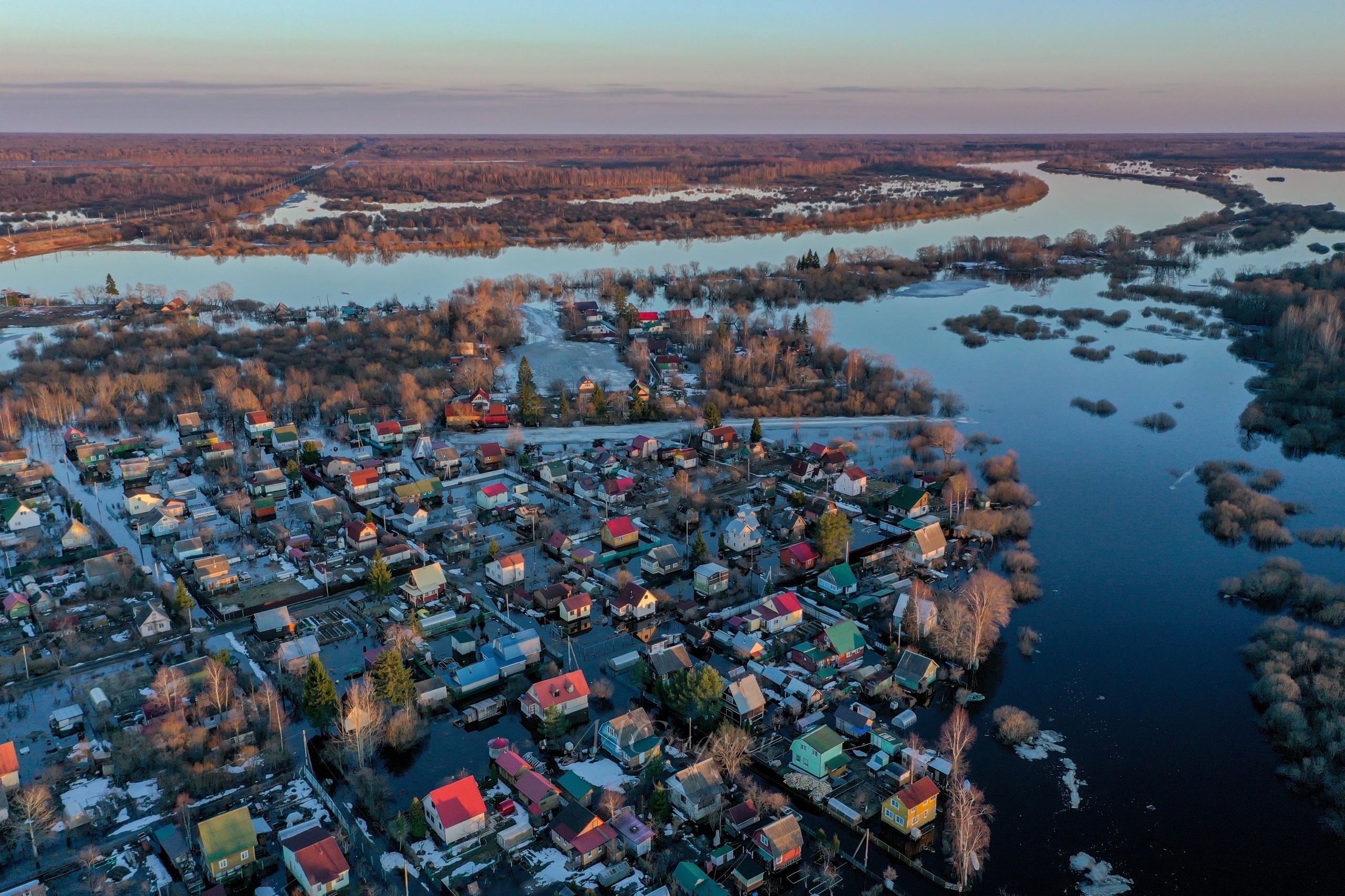
In the end of April 2016 a destructive flood occurred in Veliky Ustyug, town in Vologda Oblast, Russia. As a result of flood simulation a raster layer with anticipated water level increase is generated, it can be automatically vectorized and used for any further processing.
It is possible to use additional data and perform integration with remote data storages and geospatial data funds, etc.
To execute the flood simulation algorithm following input data is required:
- Raster digital elevation model.
- Linear vector layer or the river.
- Vector points layer with gauging stations which contain attributive information about anticipated water level increase. Minimum two gauging stations points are required on both ends of simulation area.
On the figure you can see the result of the simulation.
- As a digital elevation model a freely available SRTM data with 30 meters resolution is used. (Raster image in gradations of grey where pixel brightness corresponds to the elevation of the terrain at that point.)
- Linear vector layer of the river - the blue line.
- Vector point layer with two objects, vector attributes contain information about water level increase by 1 m.
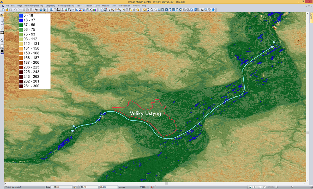
Figure shows the flood computer modeling result. Blue color represents the simulated flooding. Raster layer with the result can be automatically vectorized, and with the help of a map or satellite image operator can analyze the affected territory.
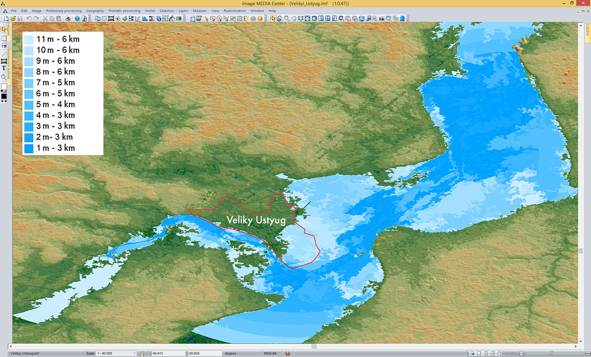
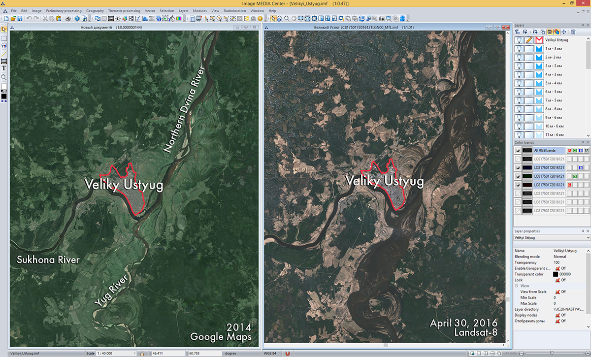
Figure shows the comparison of satellite images of Vologda region from Google maps service (2014) and Landsat-8 (April 2016). Both images contain vector border of the Veliky Ustyug town.
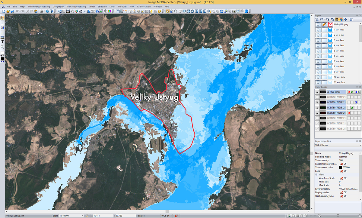
Figure shows the image of Vologda region obtained in April 2016 by Landsat-8 satellite with the vector layer of simulated flooding.
Innovative Centre Company received an acknowledgement from International Civil Defence Organisation for a valuable contribution to informational technologies of International Monitoring and Coordination Center’s (IMCC) development.